Geography and historical layout
The place where Uppsala stands today was once known as “Östra Aros” and was a trading port situated on the fertile flatlands around the banks of Fyrisån (Fyris River) a few kilometers south of Old Uppsala. The area was once covered by glaciers, as evidenced by the 30 meter glacial ridge which the castle is built upon and the huge boulders which can be seen strewn about the fields and forests. The Swedes call these stones “jättekast”, which harkens back to a folktale that they were thrown there by giants.

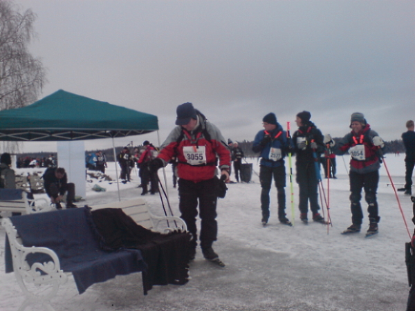
E.Grandin 2008, Participants in the Viking Run
The retreat of the glaciers over the last 11 thousand years or so has also made great changes to the landscape and to nearby Lake Ekoln, the northernmost gulf of Lake Mälaren, which the Fyris River empties into.
Lake Mälaren is the third largest lake in Sweden. During the Viking Age, it was a bay of the Baltic Sea and at that time it was possible for long ships to sail far inland. However, due to post-glacial retreat, the bay eventually became a lake, and although it is now too shallow in some places for seafaring ships, it is still possible to travel by boat from Uppsala to Stockholm and many other Swedish cities.
Lake Ekoln is also a popular place for swimming and boating in summer and ice skating in the winter. Each February, if the weather permits, there is an ice-skating contest called Vikingrännet (the Viking Run), where hardy individuals skate 82 kilometers from Uppsala to Stockholm.
The Viking Run may serve to remind one of Uppsala’s medieval past, along with various other artifacts, such as rune stones that are present around the city. However, there is very little architecture remaining from that time, primarily due to fire.
Historical layout
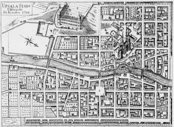
In 1702, a fire devastated the city, leaving the castle in ruins and destroying most of the buildings, like the observatory and valuable historical objects such as the life work and notes of university nobles (See engraving depicting Uppsala as it appeared at that time). After the fire, the layout for the city was completely redrawn so that only the area around the cathedral remains as it was back then.

Engraving by Fredrik Akrel. Uppsala as it looked before the great fire of 1702.
Fire was not the only means by which Uppsala lost many of its finest architectural achievements. Many buildings disappeared because of progress. During the period from 1969 to 1975 over 400 of the city’s buildings were demolished in the central part of town. What remains today is a city with a split personality, clearly divided in two by the Fyris River.

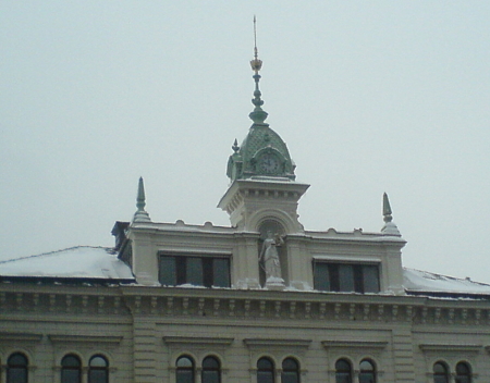
S.Pathkiller 2009, Detail of a building in the town center, CC
The most well-preserved older buildings and nearly all of the university buildings are located on the west side of the river, while the east side is devoted to industry and trade. The east side holds an eclectic mix of buildings dating from the early 1800s and forward. The central part of the city continues to draw people as seen by the number of thriving commercial businesses.

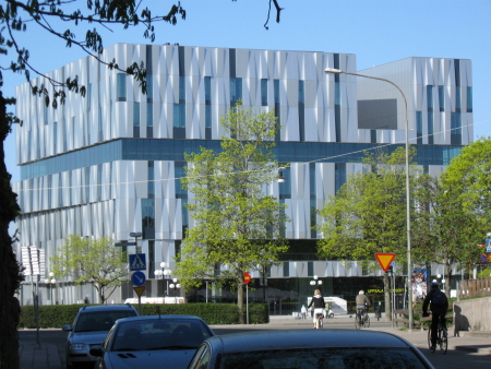
S.Pathkiller 2009, The concert house, which opened in 2007, CC
During the past 20 years, however, other commercial centers and shopping malls have been built on the outskirts of the city. The surrounding suburbs are growing rapidly and increasing population has led to a demand for more housing.